Land meets water

Where land meets water in a large city, we build homes and offices for the short walk to the beach and the long view of the open sea.  It’s a place to turn our backs on all that disturbs us in society.

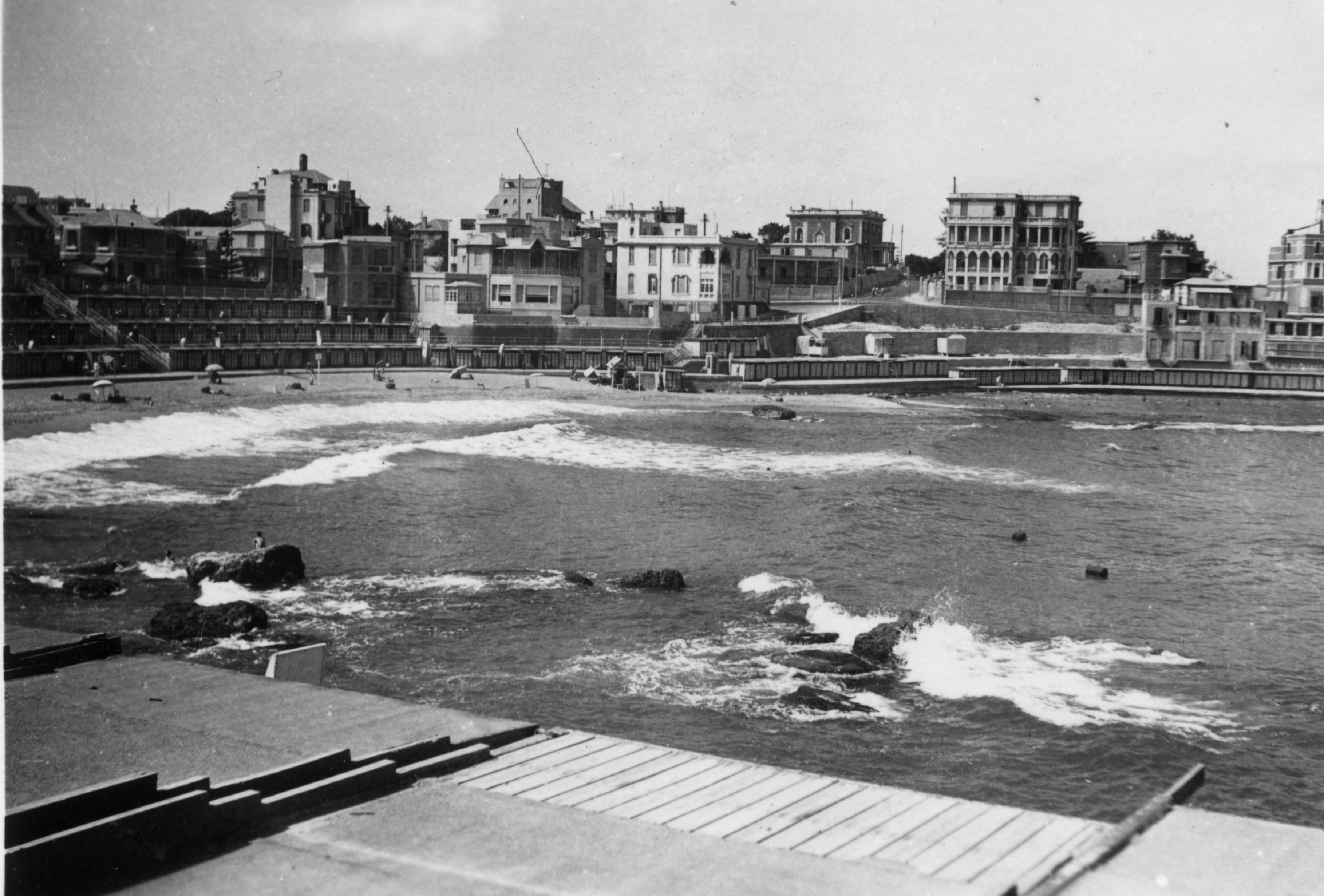
For Ailsa’s Land Meets Water photo challenge, here’s a photo of Stanley Bay, Alexandria, Egypt in about 1941.  The corniche, the road running round the coastline, was constructed in 1935.  The descending levels of concrete bathing cabins added on the shoreline form an amphitheatre that looks onto the Mediterranean.  Here in 1941 people are bathing in the sun and sea, and, by all appearances, are unafraid.  Yet in May, June and December of that year there had been fierce enemy air and sea attacks on Alexandria with hundreds of people killed and injured.  In this scene there are bathers on the sand, in the water and on the rocks, as though all is well.

Today Alexandria is not facing the same threats, but the population has multiplied.  Modern photos show the corniche lined with high-rise apartment blocks, not as picturesque as those in the 1940s, and with not nearly as much space to roam between buildings.  And town planners seem to have had second thoughts about the bathing boxes, which have disappeared.  Only the sea remains the same.

The photo is from my father’s WWII album.

Stanley_Bay_Alexandria
Stanley Bay, Alexandria, Egypt, c1941


Save

Weekly photo challenge: Street life

I’m not old enough to have taken these photos.  Lol.  They’re from my father’s war album of photos taken in 1941-42.  He was sent to the Middle East for several months and brought back photos of the places he passed through.  He wasn’t always the one behind the camera;  some of them came from friends in swaps, so I can’t know who captured these images.

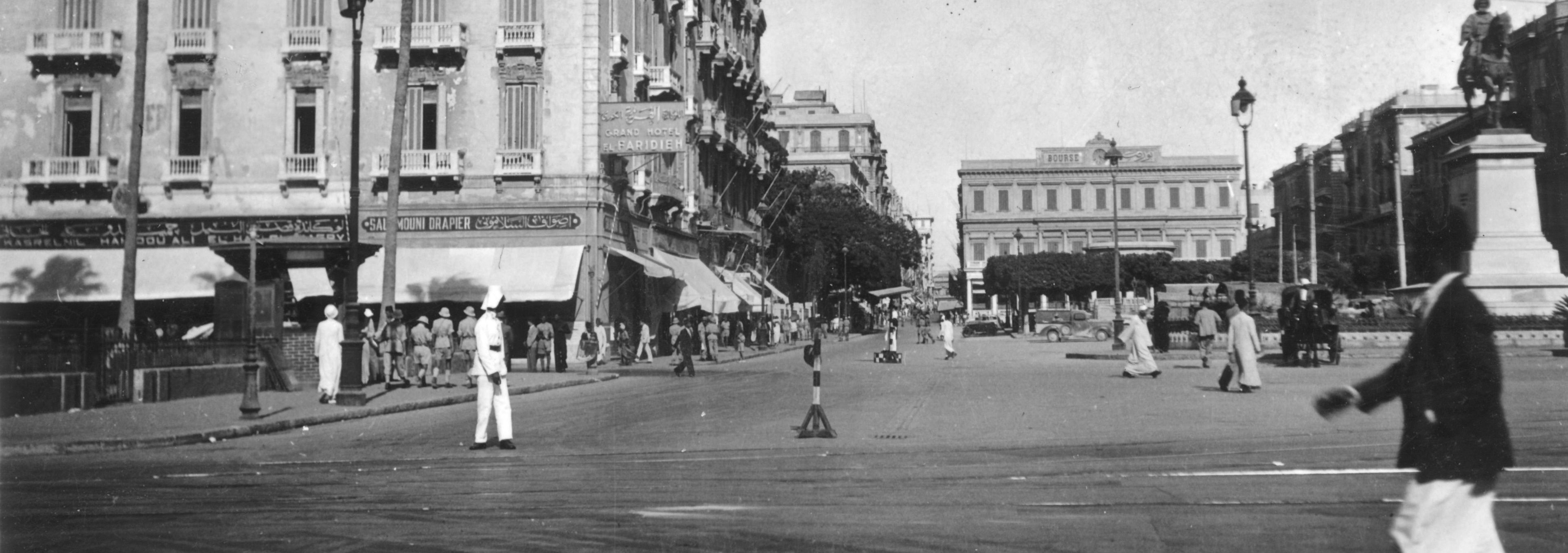
The first one is a snatch of street life during the early years of the war in Alexandria, Egypt.  Not much traffic!

In the mid-19th century, under the French, this was the Place des Consuls, where several Consulates were situated in what was then a cosmopolitan Alexandria.  It was then renamed Mohammed Ali Square in 1873 after the statue of the Ottoman governor, Mohammed Ali, was placed in the square (on the right of the photo).  British naval forces bombarded the area in 1882 and destroyed most of the original buildings.  It’s now Midan al-Tahrir, Tahrir Square (same as the famous square in Cairo).  In English, it’s Liberation Square.

Mohamed Ali Square, Alexandria, Egypt, c1941
Mohammed Ali Square, Alexandria, Egypt, c1941

The photo below is from the same album, but is unidentified.  It’s in the same era, and probably in Egypt, definitely in the Middle East, definitely during the war.  I like the perspective, the way the street curves into the distance behind buildings, and the way the buildings are flush with the street.  It’s not so much about street life since everyone seems to be inside except for a woman and two children quietly making their way  home.  The scalloped detail on the rooflines is particularly clear in monochrome, as is the mass of (what looks to be) a dovecote on the right.

Street scene, 1940s, Egypt?

I’m very thankful these days that my family kept these photos.  They’re possibly more meaningful now that several decades of history have passed, and we can compare the scenes then and now (thanks to all the images online).  Try looking for current photos of Tahrir Square in Alexandria.  The statue of Mohammed Ali is still there, but the square looks very different otherwise.  But perhaps black and white hides some of the grit of street life.

*****