Weekly photo challenge: Gathering

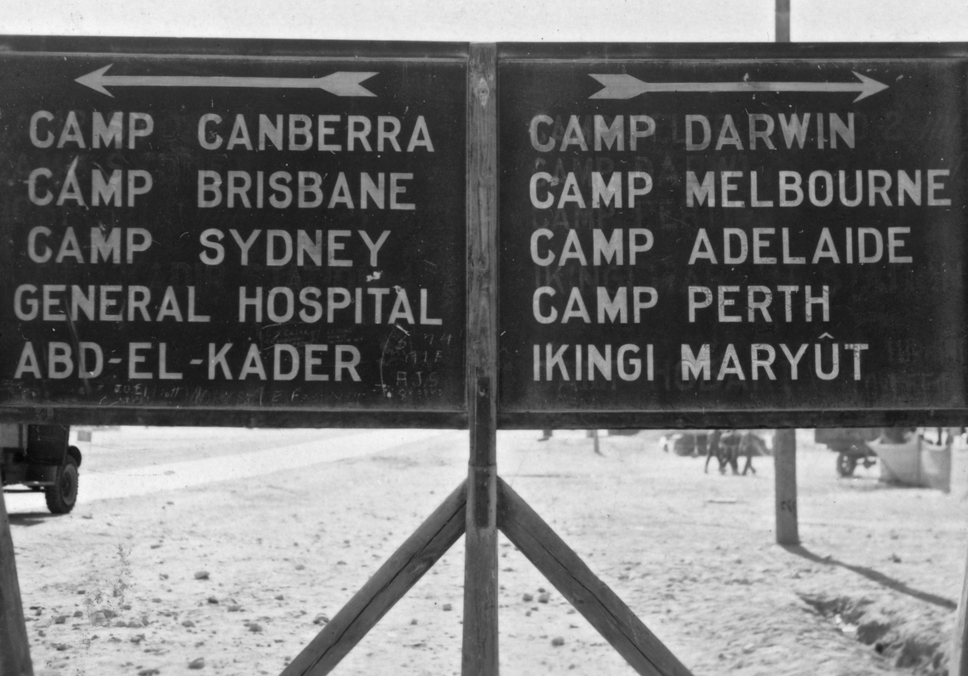
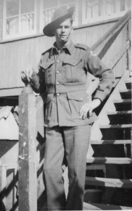
Each time I’ve looked at this photo of Lieutenant-General Thomas Blamey handing out Aquatic Sports Trophies to members of the AIF, I’ve thought I should blog about it. The photo is one of many in my father’s collection that he brought back from the Middle East in 1942, though this one was not taken by him. Similar images of this trophy ceremony in Kantara, on the eastern side of the Suez Canal in Egypt, are available on the the Australian War Memorial site, which suggest that the photo was taken on the same day, 30th August 1941. This week’s WordPress photo challenge, ‘Gathering’, gives me a reason to send it out into the world. I like looking at the individuals in the gathering who are watching Lieutenant-General Blamey giving his speech and congratulating the winners. They’re clapping, smoking and taking photos, but in particular they’re laughing. He must have cracked a good joke!

Later he became Field Marshal Sir Thomas Blamey, and here in Canberra he has a square named after him, the Field Marshal Sir Thomas Blamey Square. A mouthful.

Lieutenant-General Thomas Blamey, AIF, August 1941, Kantara, Egypt

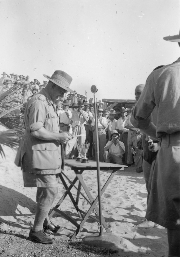
Thanks WordPress for the Gathering photo prompt!


Weekly photo challenge: Connected

Here’s a direction sign from World War II Libya.  The photo taken in about 1941 is in my father’s war album, and is marked as “Signpost Libyan Desert”.  The camps are named after Australia’s state capitals, and might have helped the Australian forces to feel (slightly) connected with home, several months’ sail away.

All the capital cities are there except for Hobart.  But this board is a palimpsest, a surface where earlier writing has been removed, scraped off, to make way for later writing.  Here, the former text has been rubbed or washed away but if you look closely you’ll see the ghosts of smaller words, including the name of Hobart.  Whatever happened to Camp Hobart?

There’s also a bit of graffiti on the bottom where a few blokes have scratched their names.

Searching for the locations of the other place names, I learnt that Ikingi Maryût was in the Western Desert outside Alexandria, Egypt, to Libya’s east.  But I’m not sure about Abd-el-Kader, though it had been the name of a popular nineteenth-century leader of Algeria, to Libya’s west.

Signpost, Libyan desert, c1941

Thanks to WordPress for the photo challenge.  See what the word ‘connected’ triggered in others.

*****

Land meets water

Where land meets water in a large city, we build homes and offices for the short walk to the beach and the long view of the open sea.  It’s a place to turn our backs on all that disturbs us in society.

For Ailsa’s Land Meets Water photo challenge, here’s a photo of Stanley Bay, Alexandria, Egypt in about 1941.  The corniche, the road running round the coastline, was constructed in 1935.  The descending levels of concrete bathing cabins added on the shoreline form an amphitheatre that looks onto the Mediterranean.  Here in 1941 people are bathing in the sun and sea, and, by all appearances, are unafraid.  Yet in May, June and December of that year there had been fierce enemy air and sea attacks on Alexandria with hundreds of people killed and injured.  In this scene there are bathers on the sand, in the water and on the rocks, as though all is well.

Today Alexandria is not facing the same threats, but the population has multiplied.  Modern photos show the corniche lined with high-rise apartment blocks, not as picturesque as those in the 1940s, and with not nearly as much space to roam between buildings.  And town planners seem to have had second thoughts about the bathing boxes, which have disappeared.  Only the sea remains the same.

The photo is from my father’s WWII album.

Stanley_Bay_Alexandria
Stanley Bay, Alexandria, Egypt, c1941


Save

Anzac Day 2015

On 25th April it will be 100 years since Australian and New Zealand soldiers charged the beaches in Gallipoli, Turkey, in an attempt to beat the Turks and give the Allies a chance to take Constantinople.  They were mown down, slaughtered.  The battles continued for months until December 1915 when they withdrew, defeated.  Out of a population of less than 5 million, Australia lost 8,000 young males at Gallipoli.

The following year, 1916, my grandfather, Ernest Bruce, joined the army after stowing away on a ship of volunteers headed for Egypt.  In July at Pozières, France, on the Western Front, he was trapped under concrete in an explosion, and then gassed.  But he survived.  He was one of the 40,000 Australians killed or wounded in 1916 on the Western Front (see AWM).  That’s a huge part of a population of 5 million.

When he returned to Australia, he was too ill to work for more than a few days a week, yet it took the government years to offer him a pension.

His oldest son was my father, Ronald Bruce, who hadn’t learnt a thing about the futility of volunteering to fight in a war.  In 1941 he joined the army, was sent to Egypt, and months later was sent home with shell shock.  He couldn’t hold down a job, and at 25 was offered a pension.

This Anzac Day, I honour my father and grandfather for volunteering to participate in Australia’s defence.

Ernest and Florence Bruce
Ron Bruce, before leaving for the Middle East, 1941
Ron Bruce, Heliopolis War Cemetery, Cairo, 1941

At the Australian War Memorial in Canberra there is a wall called the Roll of Honour.  It’s covered in the names of Australians who have died in war.  My grandfather and father are not on the wall because they returned alive;  but my grandfather’s three cousins, the Shaw brothers, and my grandmother’s two cousins, the Burley brothers, did not.  They are all buried on the Somme in France, and their names are here on the wall.  I put poppies beside their names.

Since I learnt that they were all killed while my grandfather returned, I haven’t looked at life the same way.

George Ronald Shaw, Roll of Honour, Australian War Memorial
D’arcy R. N. Shaw and Frank A. P. Shaw, Roll of Honour, Australian War Memorial

 *****

Weekly photo challenge: Symmetry

I found this photo of the Grand Hotel in my father’s war album, from his time in Egypt in 1941/42 with the AIF.  The hotel in central Cairo is part of the Gamalian complex built in 1939, designed by Kamal Ismail.  At street level are the hotel foyer and shops, above them is a mezzanine level of offices, and then eight floors of apartments.  The complex is an excellent example of stark modernist architecture with its streamlined, symmetrical arrangement of facade details, repetition of balconies, rounded corners, simple balustrades and lack of ornamentation.

On the right and left of the photo where it is out of focus there are small corner balconies on separate buildings, between which there are three pedestrian walkways leading to a central rotunda.  The walkways these days are blocked with shops and stalls, but they were designed to allow natural ventilation and illumination between the three parts of the complex, as you can see in the layout plan below the photo.

Grand Hotel, Cairo, c1941

Layout plan Gamalian Complex and Grand Hotel Cairo

I found the plan at archnet.org in a very interesting article, “Gamalian:  a rediscovery”, about the design and innovations in the complex.  The author laments the deterioration of the buildings since their construction in 1939.

Thanks to the Daily Post for this photo challenge.

*****

Depth

Derna Harbour, Libya.  Also Darna, Darnah.  A very small harbour, anchorage depth 15.5 – 16m.

In 1941, when Libya was controlled by the Italians, and the Italians were allied with Germany, the British bombarded the harbour.  My father brought home this photo.

Wreck in Derna Harbour, Libya, 1941

Thanks Daily Post photo challenge:  Depth.

Photo challenge: Cities

Ailsa has posted a photo challenge:  take her on a tour of my favourite concrete jungle.  Well I’m not partial to concrete, and I don’t have a favourite city, but I do have a favourite photo of a city.  Here’s Nairobi in 1941.  Or 1942.

Bombay, 1941/42
Government Rd, Nairobi, Kenya, 1941/42

Ailsa quoted John Berger:

‘Every city has a sex and an age which have nothing to do with demography. Rome is feminine. So is Odessa. London is a teenager, an urchin, and, in this, hasn’t changed since the time of Dickens. Paris, I believe, is a man in his twenties in love with an older woman.’

Nairobi is a young city, established in 1899 by the colonial authorities in British East Africa. So that tells us her age. But is this city feminine or masculine?  Perhaps a long-time resident of Nairobi could tell me.

It’s now one of Africa’s largest cities, with a population of 3.1 million, but look at this photo from the ’40s – not a lot of people on the street, not a lot of cars on the road.  Plenty of space for everyone.

And from the same photo album, this mosque in Nairobi, a very attractive building made of bricks, not concrete, and only three stories high, not scraping the sky. I like the man in uniform helping the woman cross the street, though she is also in uniform and obviously very competent. It was the gentlemanly thing to do. They’re easy to spot in the vast space of the uncrowded streetscape.

Bombay 1941/42
Khoja Mosque, Nairobi, Kenya 1941/42

The photos are from my father’s World War II album.

Thanks Ailsa for the prompt to find photogenic cities.

Save

Save

Weekly photo challenge: Street life

I’m not old enough to have taken these photos.  Lol.  They’re from my father’s war album of photos taken in 1941-42.  He was sent to the Middle East for several months and brought back photos of the places he passed through.  He wasn’t always the one behind the camera;  some of them came from friends in swaps, so I can’t know who captured these images.

The first one is a snatch of street life during the early years of the war in Alexandria, Egypt.  Not much traffic!

In the mid-19th century, under the French, this was the Place des Consuls, where several Consulates were situated in what was then a cosmopolitan Alexandria.  It was then renamed Mohammed Ali Square in 1873 after the statue of the Ottoman governor, Mohammed Ali, was placed in the square (on the right of the photo).  British naval forces bombarded the area in 1882 and destroyed most of the original buildings.  It’s now Midan al-Tahrir, Tahrir Square (same as the famous square in Cairo).  In English, it’s Liberation Square.

Mohamed Ali Square, Alexandria, Egypt, c1941
Mohammed Ali Square, Alexandria, Egypt, c1941

The photo below is from the same album, but is unidentified.  It’s in the same era, and probably in Egypt, definitely in the Middle East, definitely during the war.  I like the perspective, the way the street curves into the distance behind buildings, and the way the buildings are flush with the street.  It’s not so much about street life since everyone seems to be inside except for a woman and two children quietly making their way  home.  The scalloped detail on the rooflines is particularly clear in monochrome, as is the mass of (what looks to be) a dovecote on the right.

Street scene, 1940s, Egypt?

I’m very thankful these days that my family kept these photos.  They’re possibly more meaningful now that several decades of history have passed, and we can compare the scenes then and now (thanks to all the images online).  Try looking for current photos of Tahrir Square in Alexandria.  The statue of Mohammed Ali is still there, but the square looks very different otherwise.  But perhaps black and white hides some of the grit of street life.

*****

Height

Ailsa wrote a story about a slim steep-sided trail on her way to Mount St Helens, and asks us to post photos of other things that reach to the skies.

I like this photo of a pyramid emerging from the desert sands.  See the rooftop at the sandline?  It looks tiny but is probably the normal size for normal humans.  Unlike pyramids.

Pyramid_Egypt
Pyramid, Egypt, c1941,  from my father’s war album

Hidden

Tomb of Queen Hatsepshut, Valley of the Kings, Egypt, c1941
Temple of Queen Hatshepsut, Valley of the Kings, Egypt, c1941

Hidden behind tall cliffs on the west bank of the Nile is the Valley of the Kings, Biban el-Muluk, in Luxor.

And trying to hide in the rock face of the limestone cliff is the temple of Queen Hatshepsut, known as Djeser Djeseru (Holy of Holies or Sacred of Sacreds), which is the main building of the mortuary temple complex at Deir el-Bahri.  Hatshepsut ruled from 1473-1458 BC, one of the few women to rule as Pharaoh.

Excavations at the complex began in the 1890s and continued until 1936.  There seems to have been some archaeological work in progress when this photo was taken during WWII.  New photos available online (for example here), compared with the one above reveal some reconstruction since the 1940s.

The temple complex is a symmetrical structure, 30 metres tall and the length of about two and a half football fields.  On the lower terraces there were gardens; fossilised remains of trees have been found lining the walkway to the temple, fragrant incense trees which Queen Hatshepsut had brought back from Punt (south-east of Egypt, possibly present-day Somalia).  About 100 colossal statues of her as a sphinx guarded the entrance, and more massive statues of the queen wearing male clothing and a false beard adorned the temple.

The black and white photo above comes from my father’s WWII photo album.

The colour photo below is of statues of Hatshepsut in the Hatshepsut Room in the Metropolitan Museum of Art, New York.

Large Kneeling Statue of Hatshepsut Egypt, Metropolitan Museum of Art, New York

Ailsa came across a few strange hidden things in her travels and posted photos of them on her blog, then asked us to find some things hiding in other parts of the world.  Ailsa comes up with fantastic prompts for photos and blogging, and I really appreciate the ideas.  Check out her post!